 SPANISH
 Why Web Based GIS Application?
Web GIS technology has opened new paths for disseminating, sharing, displaying, and processing spatial information on the Internet
Web-based solutions provide a low-cost, efficient way to deliver map products to users

Advantages of the WEB GIS application
- Planning support
- Pipe Replacement
- Design support
- Export of Existing base map and pipe data to CAD system
- Maintenance and Pipe failure
- Checking performance as well as analysis
- Adequate management of materials
- Efficient operation
- Decision making support for Investment priority(pipe replacement, etc.)
- Quick response to customer’s inquiries/complaints
- Improvement of Water Supply Service
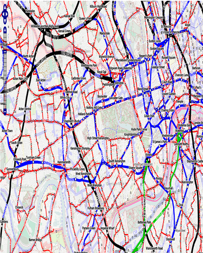
Utility Web GIS Applications
Utility web GIS (Water, Sewerage,)
Software Facility:
- A customizable information/loading screen with a map frame
- Main map windows with optional watermark/copyright text
- Key map
- Navigation controls, Overlay controls, Data extract & interface options
- Measurement tools, redlining & printing
- Querying, Including customizable map tips
- Overlay access
Web based GIS and MIS system:
- Infrastructure viewing and search /querying.
- Layer Management
- User Management
- Report generation and printing.
- Customer Query
- Pay Billing
Interactive GIS IN ACTION./
"Geographic information system (GIS) is an effective tool for storing, managing, analyzing , displaying and dissemination of spatial data & non spatial data"
GIS Mapping & Data

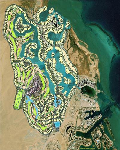
Yantram is an offshore GIS value added services provider! It specialises in undertaking GIS contracting services for various counties and municipalities to create, update and maintain the GIS data using GIS Mapping & conversion, Digital Image Processing, Landbase Data Mapping, Rectification of Orthophotographs, Conversion of paper maps to GIS etc...
Remote Sensing

We offers remote sensing services to its clients worldwide. The services ensure accurate and cost-effective data collection which is important input for planning and designing of mapping projects. Yantram ’s expertise in remote sensing branches out to meet classification, image correction, image enhancement, image processing, and change detection services.
Image Process

Our high resolution satellite imagery,image processing services for analysis to support GIS mapping and research apps. We specializes in satellite imaging collections, producing seamless orthorectified imaging mosaics, DEMs and 3D Digital Terrain Models for many industries using CAD and GIS apps utilizing high,medium resolution mono and stereo satellite image.
Industry Research & Investigation

We provide a common platform for utility companies enabling them to access business data, update network information, and manage asset records and network information.We help State and local governmental organizations to use GIS technology to make better decisions, improve operations and services to citizens, and maximize their return on investment.
Yantram SERVED INDUSTRIES in GIS
We served the industry where visualization required!
Remote Sensing & Image Processing
Remote Sensing
- Image Enchantement.
- Interprétation
- Object based image classification
- Facture Extraction
- Customer QueryDEM extraction from high resolution stereo imagery

Image Processing
- Multi sensor image fusion
- Ortho rectification and Ortho photo interpretation
- Image Geo referencing
- Image Mosaic king
- Image Tone Balancing
- Data Merging
- Image filtering
- Band rationing
- Edge enhancement & Histogram equalization

Yantram SERVED INVESTIGATION & GIS SERVICES
We served the industry where visualization required!

Natrual Resourse Managment

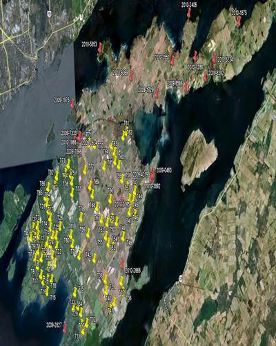
Water Utility Management

Urban/Municipal GIS

Industrial GIS

Rural Development

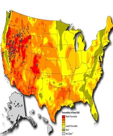
Oil & Gas Utility

Wind Mill

Tele Communication

Real Estate

ERDMP

Public Transport

Tourism
Public Health
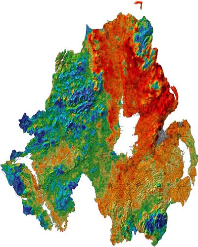
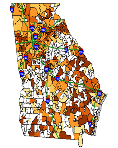
Natural Resource Planning & Management
- Land use/Land cover mapping using satellite data
- Vegetation mapping with emphasis on bio-diversity, biomass, species diversity, crown cover density etc.
- Forest mapping
- Drainage Pattern of the area
- Soil mapping
- Slope Analysis using Digital Elevation Model (DEM), Digital Terrain Model (DTM) etc.
- Watershed Prioritization for treatment purposes
- Catchment Area Treatment
- Landslide zonation and mapping of vulnerable areas.
- Socio-economic parameters in watershed management
- Flood plain mapping
- Wetlands Management
- Eco-system Assessment
- Disaster Management
Water Utility Management
- Image Procurement
- Base map creation
- Existing data conversation in GIS software
- Utility GIS Mapping, Consumer Survey and Data Integration
- Water Distribution Network including Valves, ESR, WTP etc. Hydraulic Modeling using surveyed demand / population for base, forecasted and ultimate stage scenario.
- Waste water distribution network
- Water Pipe line leak detection & topographic mapping
- Energy Audit (Preparation of DPR to detail energy savings schemes)
- Water Audit (Preparation of DPR to detail NRW in the system and improvement plan)
- Supply and installation of flow meters (Electromagnetic and mechanical)
- Development of water billing software including quarterly bill processing
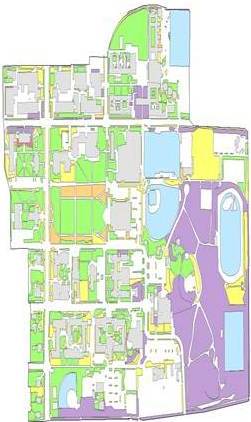
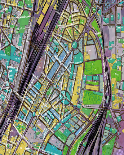
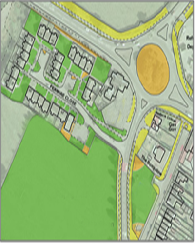
Urban/Municipal GIS
- Image Procurement
- Base map creation
- Preparation of town development plan
- Preparation of town planning scheme
- Property survey measurement
- Infrastructure survey
- Photographs linking of each property
- Urban water utility management & GIS database creation
- Geo-Spatial data integration
- Slum survey & GIS mapping ( As per RAY )
- Web based Customized application & portal
Industrial GIS
- Image Procurement
- Base map creation of industrial Estate
- Infrastructure survey & measurement
- Photographs linking of each Infrastructure
- Industrial water utility management & GIS mapping
- Waste water utility management & mapping
- Geo-Spatial data integration
- Risk Assessment & management
- ERDMP in industrial estate
- Web based Customized application

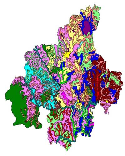
Rural Development
- Admin Boundaries
- Rural land records mapping
- Rural Asset Mapping
- Infrastructure facility Mapping
- Critical Navigation Services in far-flung rural areas
- Natural resource inventory mapping & analysis
- Socio-Economic data analysis
- Rural land use planning
- Health Infrastructure mapping & analysis
- Management for rural public engagement
Oil & Gas Utility
- Admin Boundaries
- Rural land records mapping
- Rural Asset Mapping
- Infrastructure facility Mapping
- Critical Navigation Services in far-flung rural areas
- Natural resource inventory mapping & analysis
- Socio-Economic data analysis
- Rural land use planning
- Health Infrastructure mapping & analysis
- Management for rural public engagement
Wind Mill
- Wind Turbine Site Selection
- Wind turbine location mapping
- Wind power line network distribution
- Asset Management
- Optimizing assets
- Engineering Environmental Studies
- Grid Analysis
- Land Management
- Market Assessment
- Reducing maintenance costs
Tele Communication
- Fixed wireless network distribution & mapping
- Mobile wireless network distribution & mapping
- Macro cell network designs (GSM, CDMA)
- Micro cell network designs (WLL)
- 3rd generation networks distribution
- Cable line survey & mapping
- Site acquisition
- Implementation
- Expansion
- Market research & survey

Real Estate
- Infrastructure inventory Map
- Site Selection for Infrastructure
- Land use planning & analysis
- Optimization of Road Corridor & Infrastructure
- Location Survey and Land Acquisition (As per ROR)
- Development of planning & feasibility Study
- Plan implementation
- Plan evaluation, monitoring, and feedback
- Environmental Impact Study, Management, Mitigation
- Utility network (Hydraulic, Sewerage & Gas line)mapping & analysis
- Plan transparency for citizen engagement
- Improved communications during a crisis
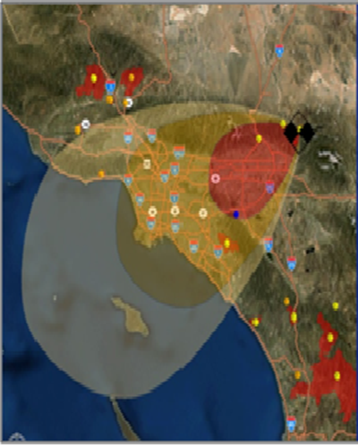
ERDMP
- Identification and mapping of key tactical and strategic facilities
- Road access for evacuation route at the time of emergency
- Damage assessment, identify casualties, and prioritize for allocation of public safety resources
- Inventory of the facility (hazardous materials)
- Fire & Rescue Team
- Logistics
- Medical aid
- Security & Civil protection
- PPE’s & Fire –detection & Protection Locations
- HSE Dept
- Emergency Dept & Services-On-site & Off-site
Public Transport
- Visualize road information
- Vehicle route network
- Visualize Route guidance & Decision make alternative route
- Location search
- Visualizing stop & upcoming stop time
- Geo coding stop location
- Real time vehicle position service
- Nearby stop service
- Vehicle stop time service
- Vehicle stop wise tourism information
- Traffic analysis & management
- Market research & Vehicle route management
Tourism
- Visualize road information
- Vehicle route network
- Visualize Route guidance & Decision make alternative route
- Location search
- Visualizing stop & upcoming stop time
- Geo coding stop location
- Real time vehicle position service
- Nearby stop service
- Vehicle stop time service
- Vehicle stop wise tourism information
- Traffic analysis & management
- Market research & Vehicle route management
Public Health
- Public health infrastructure mapping
- Research Tools and Planning
- Spatial Decision Support Systems
- Identify of risk location
- Study Vulnerable area
- Emergency Response Systems
- Manage at the emergency time
Head Office (India)
YANTRAM BPO Services Pvt. Ltd.
603 - 604, Samedh Tower B/s HSBC Bank,
C.G.Road Ahmedabad, 380009, India.
+91-9909705001 (India)
+1 2143770441 (USA)
Branch Office (Texas)
YANTRAM Animation Studio Corp.
118 cross timbers road Flower mound,
Texas, 75028, USA.
+1-214-377-0441 (USA)
Branch Office (New York)
YANTRAM Animation Studio Corp.
104-19 Queens Blvd Forest Hills,
New York, 11375, USA.
+1-310-341-3876 (USA)
Melbourne (Australia)
3/2 Hanna Court, Braybrook, Melbourne, Victoria, 3019
Melbourne,3019,Australia.
.